
Categories
Technology for precision and digital farming
Technology for precision and digital farming
Agricultural machinery electronics
GPS applications
Field robotics
Remote sensing and drones
ISOBUS
Autonomous autoguidance
Management software
Accounting software / apps
Navigation Software
Arificial Intelligence (AI)
Electronic control units (ECU)
Electronic components
Product description
Multi-view system, easy to use for dynamic surface cut and fill.
Useful for constructing flat tracks as well as simple, double, or multiple slopes. Allows the use of stake points.
Supports industry-standard file formats: dwg, dxf, LandXML, and uses global projection maps.
Ruggedized equipment designed for use in extreme conditions, featuring high-performance sensors adaptable to different machines.
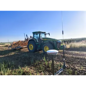
Equipped with the most advanced RTK technology on the market, as it uses all currently available GNSS constellations and is ready for future on